 ABC News(NEW YORK) — Two systems are set to bring unsettled weather across the country as revelers get ready to ring in the new year.
The first system in the Northwest is the colder one and it’s bringing snow and some of the coldest air of the season. The second system in the South is pulling in Gulf moisture and enhancing the heavy rain for the Tennessee Valley and eastern U.S. on New Year’s Eve.
The system in the Northern Rockies has already brought heavy rain and gusty winds to western Washington. It is mild in comparison to what they’ve seen in their last few wind storms, but gusts still reached over 40 mph in the area.
The higher winds are further inland, with numerous gusts over 60 mph in Washington, Montana and Wyoming. Montana even had a gust of 102 mph in the mountains.
A winter weather advisory is in place through Sunday morning for the central Cascade Mountains in Washington, where they could see a foot of snow. Around Snoqualmie Pass, an hour east of Seattle, extra crews were called in to help get a head start on dealing with the snow.
The snow amounts won’t be as high as they were over the Rockies as the system pushes east through the Dakotas and Minnesota, but 2 to 4 inches are expected along with blustery winds over 40 mph. Travel will be difficult through Monday.
As the system in the South develops, it will bring a chilly rain to eastern Texas on Sunday, before heavy rain moves east into the Tennessee Valley overnight into Monday morning.
Rain totals will generally be 1 to 2 inches, but isolated totals could reach 3 inches, especially from Arkansas to Tennessee and Kentucky.
Heavy rain late last week — more than a foot in some areas — led to flooding in numerous spots across the south and east. Although the rain won’t be too intense this time, there is still a chance for flooding since more than a dozen spots in the east have seen their wettest year on record.
In addition to the rain, some strong to severe storms are possible from southern Kentucky through Tennessee and into Mississippi and Louisiana on Monday.
The heaviest rain will be pushing through the Northeast by midnight on New Year’s Eve into Tuesday.
The backside of the system will bring snow across the Great Lakes.
The majority of the East Coast will be clear of rain by Tuesday morning.
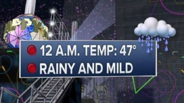
The biggest story on New Year’s Eve will be the rain in the Northeast, but one bit of good news is that it will be mild as we ring in the new year in the east.
Last year was the second-coldest New Year’s midnight temperature on record in New York City at 9 degrees with a wind chill of minus 4. This year, if the temperature reaches 50 at midnight, it will even make it into the top-5 warmest midnight readings in the city.
The first system moving through the Northwest and Rockies is bringing in bitter cold air behind it.
This will be the coldest air of the season for parts of the country and potentially the coldest temperatures in five years for parts of New Mexico.
The temperatures will keep dropping through the day Monday and, as this arctic front slides through, the wind chills will reach dangerous levels on Tuesday morning from New Mexico to the Dakotas and Minnesota. Some places in the north could see wind chills as low as 35 degrees below zero.
Copyright © 2018, ABC Radio. All rights reserved.


