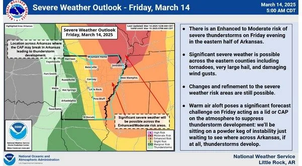
North Central Arkansas could see strong to severe thunderstorms Friday afternoon and evening as a powerful storm system moves into the region. While the best chances for storm development remain across southern Missouri, the potential exists for severe weather in the Twin Lakes area if storms manage to break through what meteorologists call a “capping inversion.”

“If those storms do develop further south into north central Arkansas, they will have the capability of becoming severe,” said National Weather Service Meteorologist Willie Gilmore to KTLO News Friday morning.
The primary threats with any storms that do form include large hail, damaging winds, and even the potential for tornadoes. However, there is still uncertainty about whether storms will develop in North Central Arkansas. Gilmore noted that some indications suggest storms may hold off, which would be good news for the region.
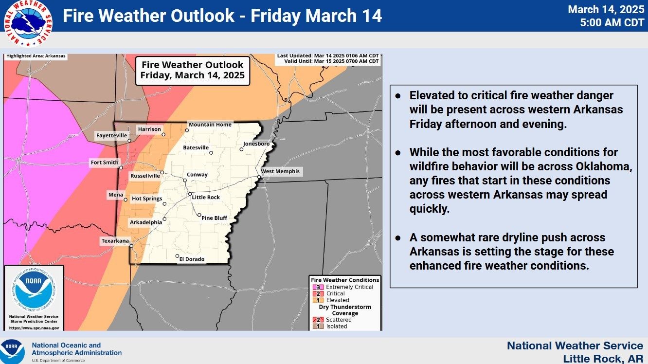
Beyond the storm threat, strong winds unrelated to thunderstorms will impact the area. Winds of 20 to 35 mph are expected, with gusts reaching up to 40-50 mph and possibly higher in parts of northwest Arkansas. “These aren”t even associated with any thunderstorms, these are just general winds, so it”s going to be very windy today across the area,” Gilmore said.
In addition to the storm and wind threats, dry air moving into the region later Friday afternoon and evening will bring an increased fire danger. With low humidity, strong winds, and recent dry conditions, any fires that start could spread rapidly. A Red Flag Warning has been issued for the region due to these concerns.

Conditions will improve overnight into Saturday morning as the severe weather threat moves east and winds begin to subside.
Stay tuned to KTLO, Classic Hits and the Boot for the latest in severe weather coverage.
WebReadyTM Powered by WireReady® NSI


