


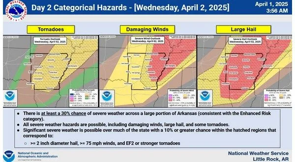
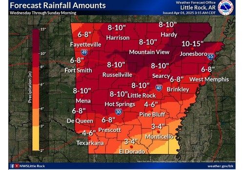
More severe weather is making its way towards the Twin Lakes area Wednesday with threats of very large hail, damaging winds and the threat for tornadoes. This will be followed by multiple rounds of flooding rains through the rest of the week with the possibility of 10 inches or more of rain.
In a severe weather briefing from the National Weather Service (NWS) early Tuesday morning residents in North Central Arkansas can expect storms to move in to the area starting mid day and continuing through the afternoon. Baxter, Marion Fulton and surrounding counties are in an enhanced risk or a 3 out of 5 scale for severe weather Wednesday with hail upwards of baseball size, maximum winds of 60-80 mph and a chance for EF2 rated tornadoes to develop.
Multiple rounds of storms will proceed on Thursday and Friday although severe weather chances will stay lower with those systems. The main concern will be the heavy rain fall from Wednesday through Saturday. Current estimates place the Twin Lakes area at receiving 6 plus inches of rain with the possibility to see upwards of 10 inches.
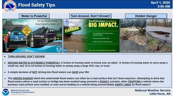
Residents will need to stay aware of areas where flooding could occur as rising water impact low water crossings, creeks and rivers. Stay tuned to KILO News for the latest in severe weather coverage.
WebReadyTM Powered by WireReady® NSI