


Images courtesy of National Weather Service
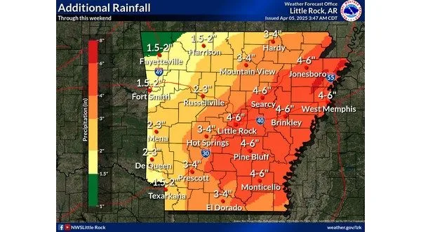
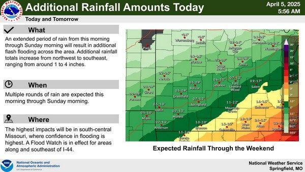
More rain is expected throughout the Twin Lakes Area this weekend, leading to additional flooding concerns. A flood warning is in effect for Ozark, Howell and Douglas counties until 11 Saturday morning. A flood watch remains in effect through Sunday morning for north central Arkansas and through Saturday evening for southern Missouri.
Meteorologist Willie Gilmore of the National Weather Service office in North Little Rock says while the rain has lightened up, heavier precipitation is on the way.
Listen:
With the recent rains, some area rivers have gone above flood stage in various areas. Gilmore says it may be a couple of days before some the local waterways crest.
Listen:
At last update, the White River above flood stage in two areas. The river was at 22 feet at Calico Rock, 3 feet above its flood stage. The White River was also at 17 feet at Batesville, 2 feet above the flood stage. At Norfork, the river has risen from 5 feet Friday to 22 feet Saturday morning.
Crooked Creek is at 22 feet in Yellville. The Buffalo National River is at 23.4 feet in St. Joe, where the flood stage is 27 feet.
The National Weather Service is not expecting a threat of severe weather in the Twin Lakes Area. Gilmore says most of the severe activity is expected in the southeastern portions of Arkansas.
Tune in to KTLO, Classic Hits 101.7 and 99.7 The Boot for the latest weather coverage.
WebReadyTM Powered by WireReady® NSI