


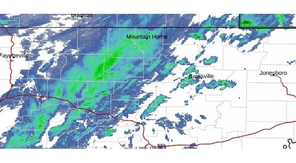
This is a radar image from the National Weather Service captured just after 6:30 Sunday morning.
While the rain has stopped falling in some portions of the Twin Lakes Area, it may not be completely over yet. A flood warning does remain in effect for Fulton, Izard and Stone counties in north central Arkansas until 7:30 Sunday morning, and another flood warning for southern Missouri expires a half hour later.
Meteorologist Chris Buananno of the National Weather Service office in North Little Rock says there may be one more round of light rain on Sunday.
Listen:
Fellow Meteorologist Willie Gilmore had some additional good news as it appears the area rivers in north central Arkansas have started to crest sooner than originally predicted.
Listen:
At the last update, the Buffalo River had dropped to 28.52 feet at St. Joe. The White River was just starting to drop at Norfork as it is at 28.55 feet. The Spring River has seen the biggest drop at Hardy as it is at the minor flood stage of 13.16 feet.
The Twin Lakes Area will be dealing with colder temperatures as the rivers continue to drop. North central Arkansas will be under a frost advisory Monday morning from 2 to 9, and southern Missouri will be under a freeze warning from 11 Sunday night to 9 Monday morning.
WebReadyTM Powered by WireReady® NSI