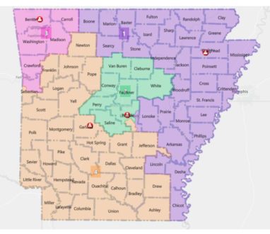
When Arkansas Gov. Asa Hutchinson let a new congressional election map become law last week without his signature, much of the talk across the state concerned the division of Pulaski and Sebastian counties. But the new map has significant implications closer to home, with two nearby counties, Marion and Boone, moving from the third to the first congressional district, as Baxter County did 20 years ago.

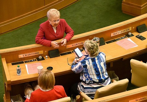
Rep. Nelda Speaks (top) talks with Rep. Cindy Crawford (left), R-Fort Smith, and Rep. Denise Garner, D-Fayetteville, during a recent legislatifve session.(Arkansas Democrat-Gazette/Staci Vandagriff)
The former bookkeeper and county treasurer took a keen and early interest in a process strongly guided by calculations.
Listen:
Arkansas’ population grew to 3.01 million, according to the latest census numbers. With those census numbers, lawmakers attempted to keep the number of constituents for each U.S. representative as close to 752,881 as possible so that one citizen’s vote in a congressional election is worth the same as another citizen’s vote.
Significant population growth in Northwest Arkansas and decreased numbers across the state’s delta are the primary drivers behind the realignment of the four congressional districts.
But a number of factors must also be considered beyond the population, following Arkansas Board of Apportionment standards and requirements. Speaks says the list includes maintaining communities of interest where possible, such as farming in the first district, business and industrial in the third and timber in the fourth.
Listen:
Like Hutchinson, Speaks is predicting a court challenge to the legislatively-adopted map.
Listen:
Speaks’ House Bill 1982 is a companion to Senate Bill 743 sponsored by Sen. Jane English of North Little Rock. Their bills are the first redistricting plans to be passed by a Republican-controlled Arkansas Legislature since the Reconstruction era. The GOP gained control of both chambers for the first time in the 2012 election.
WebReadyTM Powered by WireReady® NSI


