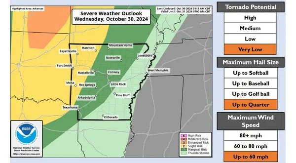
NWS graphic shows marginal risk of severe weather for NCA
After one of the driest Octobers on record relief is on the way Wednesday night into Thursday morning as a strong cold front marches across the state from the west bringing rain and a chance of severe weather early into Halloween.
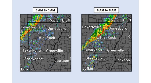
In a report from the National Weather Service in North Little Rock Wednesday morning, thunderstorms are expected to become widespread across Kansas and Oklahoma late Wednesday afternoon before moving into western Arkansas by late evening. There is a marginal chance that these storms remain severe as they move across the state towards North Central Arkansas with the primary threat being high winds of up to 60 mph. The tornado potential remains very low with this system. Impact times for the Twin Lakes appears to be approximately from 4 to 8 Thursday morning. Rainfall totals could be up to 3/4 of an inch which will bring welcome relief to very dry conditions and begin the process of lowering wildfire risks.

NWS simulated radar shows timing for line of storms early Thursday
Halloween festivities are expected to see dry conditions by later in the day with comfortable temperatures as trick or treaters get out Thursday evening. Additional rain and thunderstorms are expected across the area Saturday through the middle of next week with western Arkansas favored for the highest additional rainfall totals.
Stay tuned to KTLO, Classic Hits and The Boot for the latest in local weather coverage.
WebReadyTM Powered by WireReady® NSI


