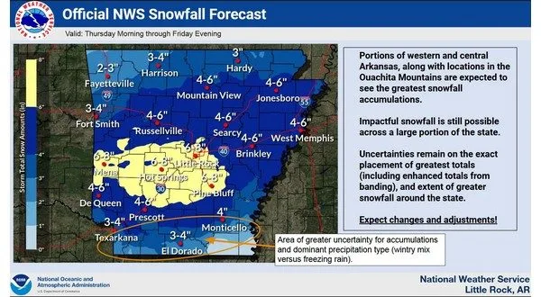
Thursday night at midnight through 6 Friday morning is setting up to be the time frame for the heaviest snow fall in latest models from the National Weather Service Wednesday morning.
Winter precipitation will begin Thursday in the evening and could continue until noon Friday as the system moves to the east. Central Arkansas is forecasted to see the greatest impact with the possibility of 6-8 inches of snow. Winter Weather Warnings and Watches have already been activated for those areas.
In North Central Arkansas the models continue to show a strong chance of 2 to 4 inches with areas like Marshall and Mountain View possibly seeing up to 6 inches.
Moisture from the Gulf of Mexico continues to be the deciding factor on how much snow will fall as a southern system will interact with low pressure system coming from the west that has been fueling wildfires in California.
Stay tuned to KTLO, Classic Hits and the Boot for the latest in weather, cancellations and road conditions.
WebReadyTM Powered by WireReady® NSI


