


Images courtesy of National Weather Service
As we get closer to the forecasted wintry conditions this week, residents are getting ready for what could be a significant winter weather event.
KTLO, Classic Hits and the Boot News spoke with National Weather Service meteorologist Colby Pope Monday evening to get the latest update on what models show will impact the area.

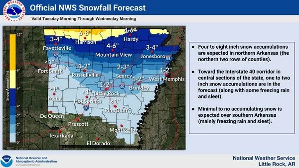
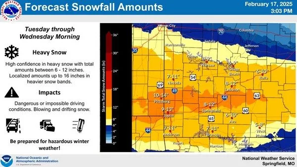
Pope says that while snow will be the dominant form of winter precipitation during this event, he does expect we could see snowfall reaching the area around 6-7 A.M. Tuesday and continuing up to early Wednesday morning, bringing in 4-6 inches of snow across the area with some areas receiving as much as 8 inches.
Listen:
Stay safe, stay warm and keep your radios tuned to KTLO, Classic Hits and the Boot for the latest in winter weather updates, road conditions, and closing and cancellations brought to you by Baxter Health.
TRANSCRIPT:
Colby Pope:
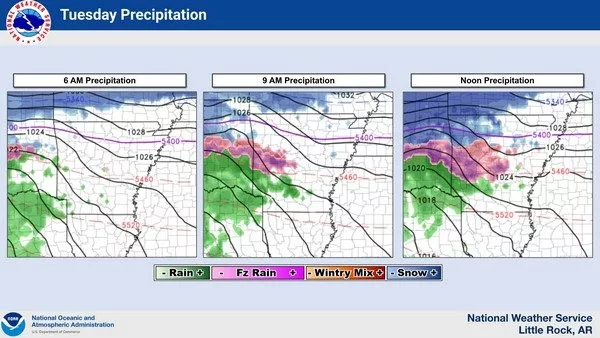
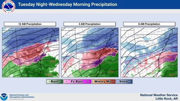
This event will actually start in the early morning time frame around 6 to 7 in the morning. That’s when we’ll start to see that snow move in, and that should be the dominant precip type for this whole event across your area. And this will continue throughout the day on Tuesday and remain even into the day on Wednesday before coming to an end during the early morning hours on Wednesday around 6 a.m.
Now, as far as totals go across the listening area, there could there could be a variance, but we do feel pretty locked in with a snow total of anywhere from four to six inches will be widespread with some areas that could see upwards of eight inches as you approach the Missouri border with Arkansas.
Definitely we’ll start to see road conditions become impacted especially as that heavier snow starts to fall. That will be later Tuesday morning just before the noontime hours. I think you’ll start to see road conditions really start to decline even before the noontime hours.
So you know, even getting out in the morning, I think will be really questionable because you’ll really start to see those road conditions decline. And I’d really be hunkered down. Even I would be where you need to be around 9 a.m. Actually, I really would because from 9 a.m. to 12 or noon, that’s really when you’re going to start to see that heavier snowfall. And then that’s really when you start to see those roads start to become a little bit more overwhelmed as with the precip.
WebReadyTM Powered by WireReady® NSI